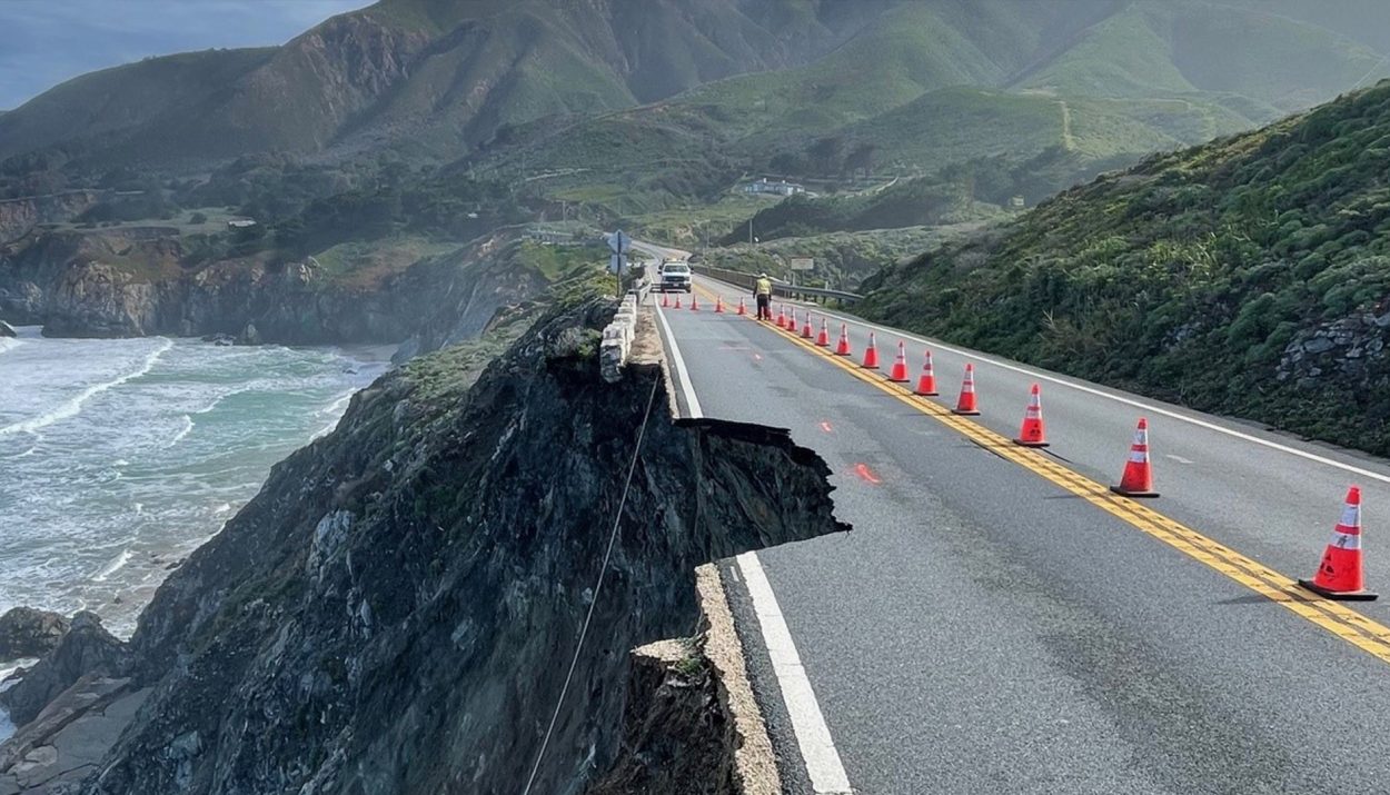
California’s Highway 1 is one of the country’s most beautiful and scenic drives. The iconic highway hugs the Pacific coast and offers motorists some spectacular cliffside views. On Saturday, however, a portion of Highway 1 washed down a cliff and into the ocean following a storm.
The landslide and ensuing road closure stranded about 1,600 people – many of whom were tourists spending time at Big Sur for the Easter holiday – forcing them to spend the night in their vehicles or temporary shelters. Let’s look at how the unique geography of coastal California makes Highway 1 a treacherous stretch of roadway.
Heavy Rains, Soaked Soil, and Gravity
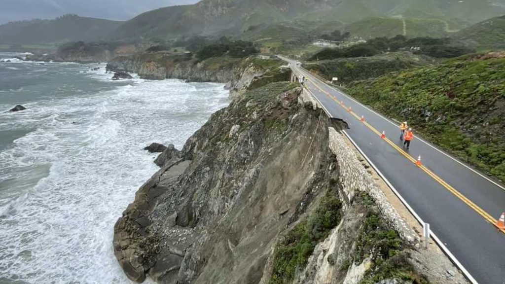
A major storm dumped heavy rains on parts of California over the weekend. The rainwater washed away some of the earth supporting Highway 1 as the heavy, water-soaked soil tumbled down the side of a soaring cliff overlooking the Pacific Ocean.
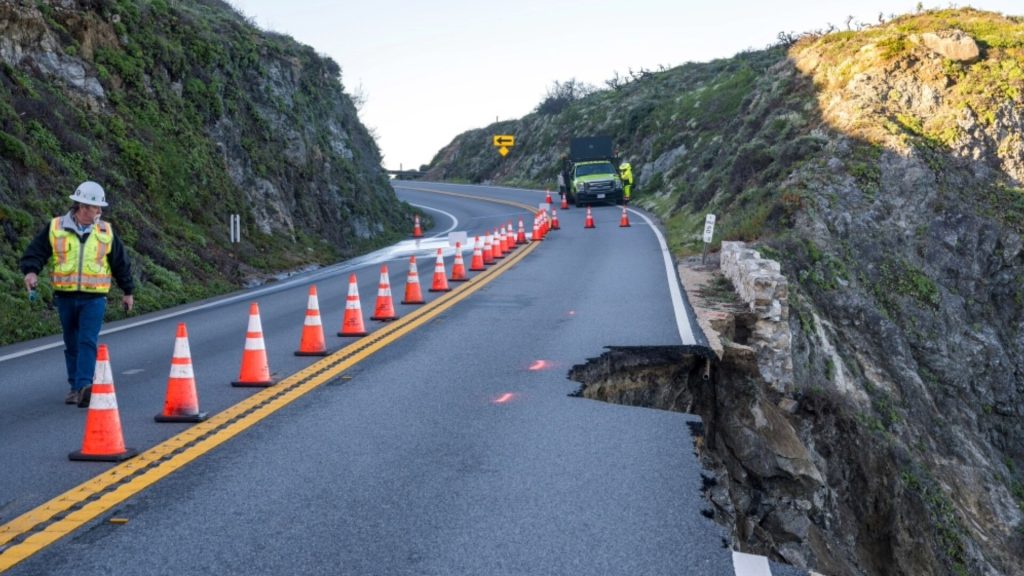
A sizable portion of the southbound lane of Highway 1 washed out just south of Rocky Creek Bridge, not far from Carmel-by-the-Sea in Monterey County. Authorities closed roughly 40 miles of the road from south of Limekiln State Park to just north of Palo Colorado.
Tourists and Locals Were Trapped
The road closure left more than 1,600 people trapped and unable to drive out of the impacted area. Most of these people were visiting the state parks in the area for the Easter weekend. Most of the stranded motorists were able to spend Saturday night in area hotels.
State authorities report, however, that many people also stayed in temporary shelters that were quickly opened for them. A few others opted to sleep in their cars.
Escorting People to Safety
After engineers from the state highway department determined that the northbound lane of Highway 1 was safe, police escorted the stranded motorists out of the area. Motorists were taken in convoys from the parks, shelters, and hotels.

According to the Monterey post of the California Highway Patrol, everyone who wanted to leave was escorted out by Sunday. They added that two more convoys were planned for Monday – at 8 a.m. and 4 p.m. – for any remaining people who need to be escorted out.
State Parks Will Be Indefinitely Closed
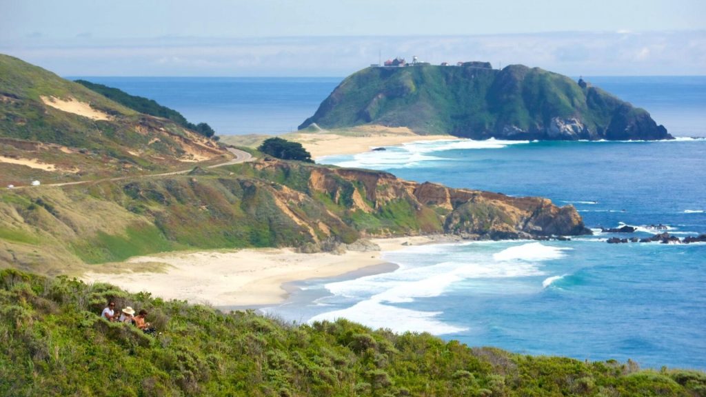
The closure of Highway 1 also means that some of California’s state parks will be closed indefinitely. Those include Pfeiffer Big Sur State Park and Point Big Sur State Historic Park, as well as Limekiln, Andrew Molera, and Julie Pfeiffer Burns state parks.
Guests who have reserved campsites in these parks will be issued a full refund. Officials with the state parks department explained that the timeframe for reopening the parks will depend on how quickly the highway crews can make the necessary repairs to Highway 1.
An All-American Road
Highway 1 runs more than 650 miles and stretches along most of California’s Pacific coastline. Unlike many of the nation’s other major highways, Highway 1 was not constructed in one single project. Rather, it involved piecing together from several existing coastal roadways.
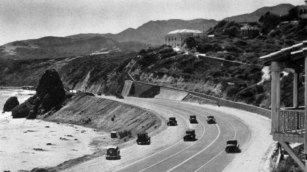
The first portion of what is now Highway 1 was constructed in the Big Sur area in the 1930s. This was also the most difficult portion of the route. The high cliffs, rocky outcroppings, and rugged beaches made this a formidable place to build a road.
Highway 1 Was Built Using Convict Labor
Beginning in 1919, the state of California began making plans to build a road connecting Carmel and San Simeon. In 1921, voters approved the allocation of state funds for the construction project. But it was a big, big job that involved building 33 bridges in addition to the highway.
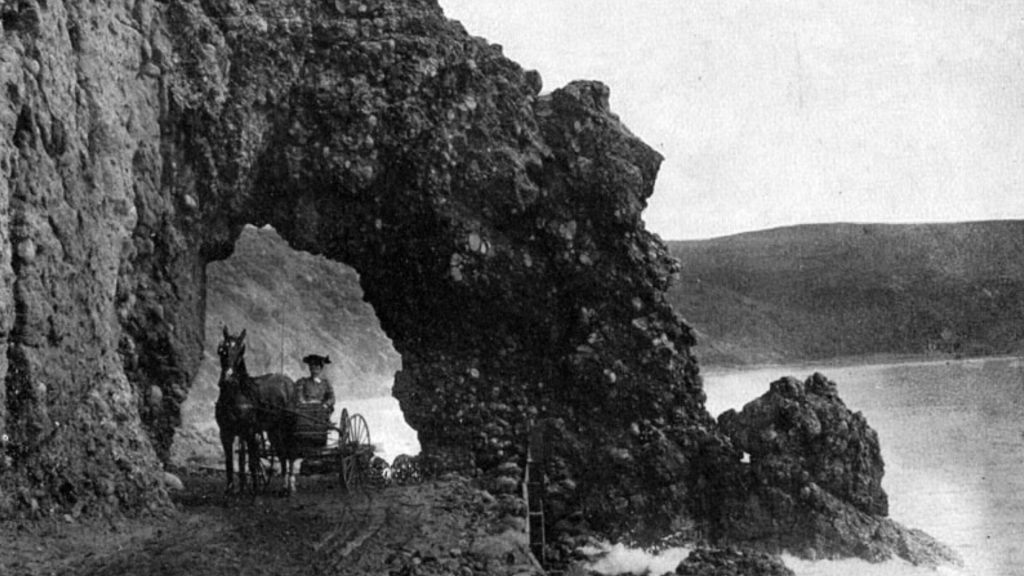
Much of the work was done using convict labor. Unskilled, untrained inmates from San Quentin State Prison were divided into three prison camps – one at Anderson Creek, one at Little Sur River, and one at Kirk Creek. It was not a forced-labor situation. The inmates who agreed to do the work were compensated with 35-cents per day and a reduced prison term in exchange for their work.
18 Years of Work
This portion of Highway 1 took 18 years to complete, in part because it included the construction of 33 bridges. Additional funds from Franklin Roosevelt’s New Deal program helped California finish the project. In fact, the road became known as the Roosevelt Highway in his honor.
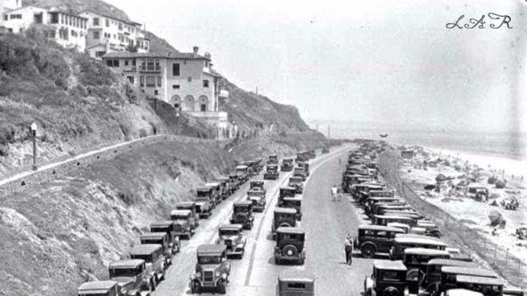
The Roosevelt Highway, which stretched from Carmel to San Simeon, officially opened on June 17, 1937. Over the years, however, most segments of the highway were added to connect the Roosevelt Highway with other roads along the California coast.
Becoming Highway 1
By the late 1950s, it was possible for motorists to drive the length of California, mostly along the coast. In 1964, the entire length of the highway was given a new name, Highway 1, as part of the state’s highway renumbering plan.
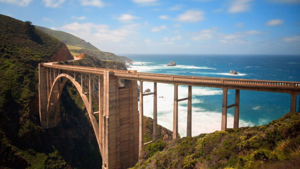
Since then, Highway 1 has become an iconic American road and for good reason. It offers some of the most stunning and untamed views in the state, including numerous overlooks where motorists can view the powerful Pacific surf, watch sea lions lounge on the rocks, and even see whales breaching in the sunset.
Complex Geography Makes It a Treacherous Stretch of Road
The ruggedly beautiful landscape of Big Sur and Highway 1 are thanks in part to the region’s tectonic activity. The mountains, canyons, and cliffs were created by the numerous faults that crisscross the area.
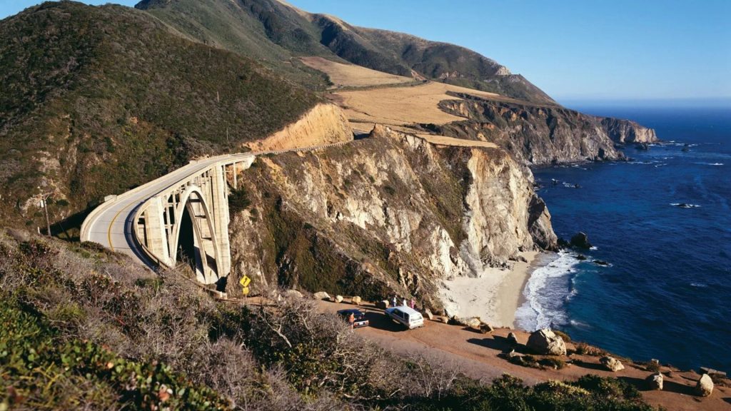
The tectonic activity has caused the land to thrust upward, forming steep slopes. In fact, this area boasts the steepest coastal cliffs in the lower 48 states. This all means that large portions of Highway 1 are prone to landslides, wash-overs, and erosion. It is not uncommon for sections of Highway 1 to be closed while crews repair the damage done by collapses and landslides.
Assessing the Damage
By now, engineers with the California Highway Department are well-versed in assessing the damage and making repairs to parts of Highway 1 that have been damaged because of the area’s unique geography. After Saturday’s road collapse, crews stabilized the remaining parts of the road.
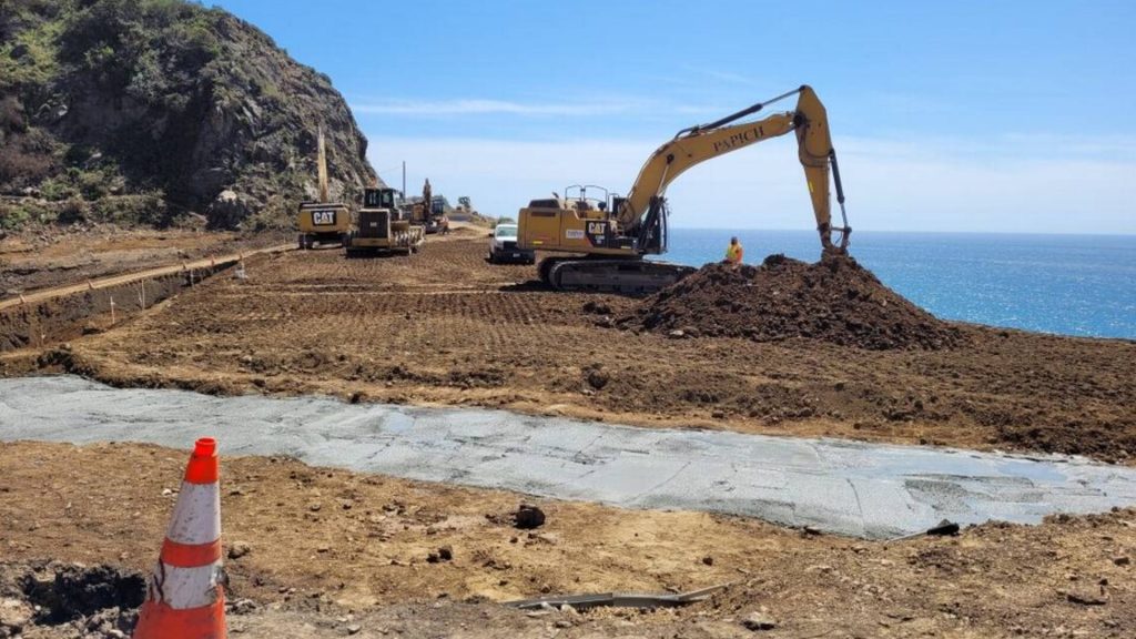
Because of safety concerns, traffic through the impacted areas is being rerouted to roads and highways further inland. Nicholas Pasculli, director of communications for Monterey County, said, “We want to emphasize that this is a state disaster.”
Continued Road Repairs
Prior to this recent incident, the California Highway Department had hoped to fully reopen all parts of Highway 1 by May of this year. A few large landslides in the early months of 2023 caused damage that, according to experts, took “multiple months of work” to repair.
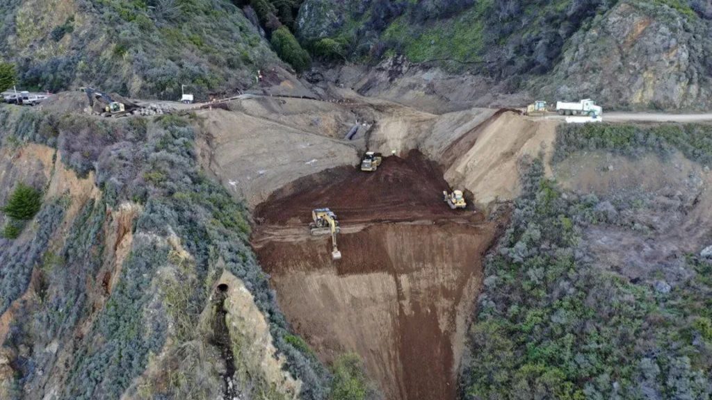
Although the road crews were about to keep traffic flowing with intermittent lane closures, this new collapse pushed back the timeline for repairs. The heavy rains that caused Saturday’s road collapse have also made it difficult to complete the earlier repairs in a timely manner.
“Keep Californians Safe”
California’s governor, Gavin Newsom, took to social media on Sunday to express his concern and to thank work crews. He noted that his office was “coordinating closely” with other state and local agencies.

He added that he deeply appreciated the efforts of engineers and highway crews who spent their Easter holiday “working around the clock to repair the roadway and keep Californians safe.”
Highway 1 Has Been Called an “Engineering Folly”
In an article about Highway 1 that appeared in The Washington Post in 2021, the author wrote, “The engineering folly of a road built on sheer cliffs has meant that closures are annual events – the ‘whens,’ not ‘ifs’ – for the people and the economy it supports.”
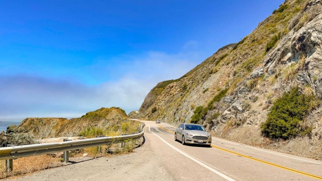
The cliffs of Big Sur are not the only issues of concern. As climate change increases the intensity of weather events, stronger storms, torrential rains, and wildfires are more apt to trigger landslides, erosion, and pavement crumbling along Highway 1. As breathtaking and scenic as Highway 1 is, it is also a risky, treacherous stretch of road.

