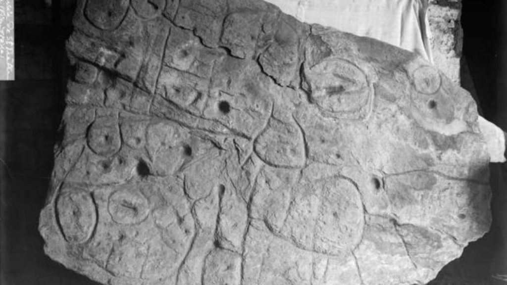
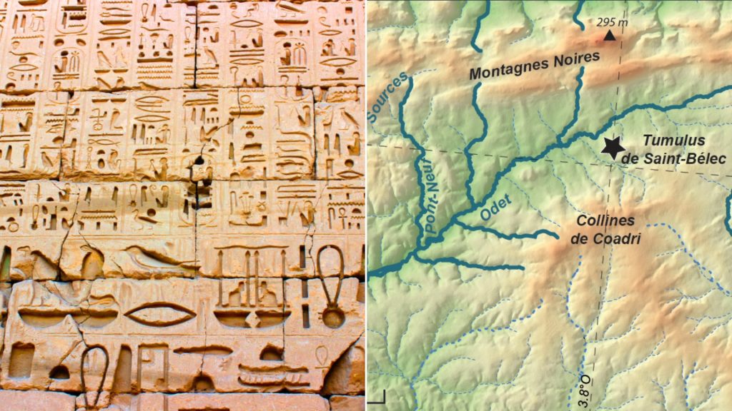
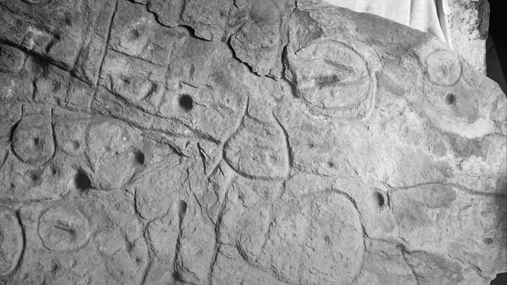
Europes oldest known 3D map, the Saint-Belec slab, has captivated researchers and archaeologists alike. This 4,000-year-old stone has been hailed as a treasure map to ancient sites in north-western France. The slab, measuring 5 feet by 6.5 feet, bears markings which resemble an 80 percent match to a 29-kilometer stretch of the Odet River. This remarkable find has sparked excitement and curiosity among experts, who are now using the stone to uncover the secrets of the Bronze Age.
A Journey Through Time: Rediscovering the Enigmatic Saint-Belec Slab from the Bronze Age
The story of the Saint-Belec slab begins in the Bronze Age, when it was first discovered at a prehistoric site in Finistere, France. However, it remained largely unstudied and its significance was not fully understood until its rediscovery.
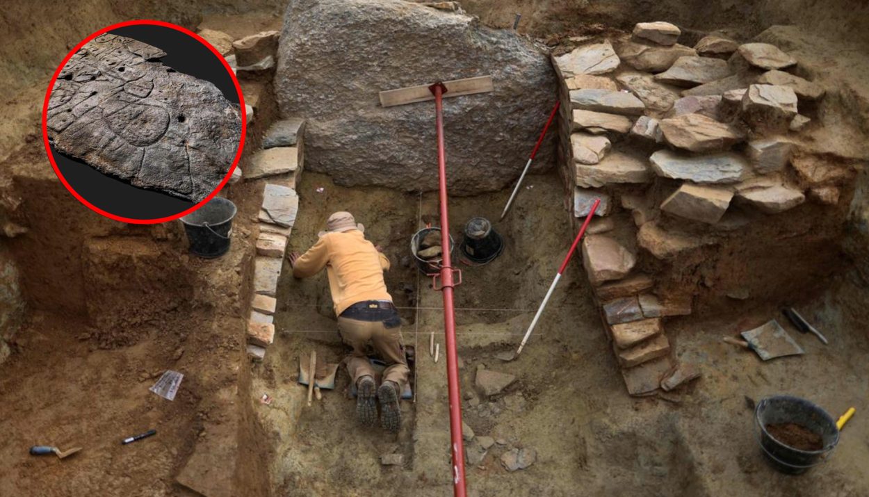
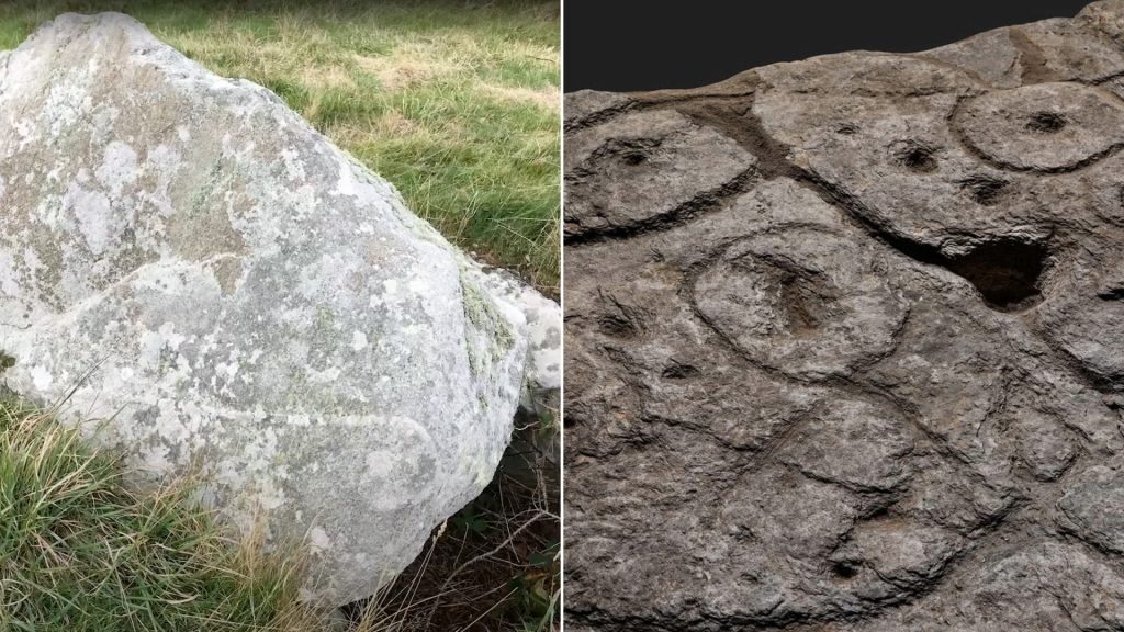
The broken slab, measuring 3.86 meters long and 2.1 meters wide, was re-used in the burial of Saint-Belec during the late Bronze Age. It was stored in various locations over the years, including a niche in a castle moat and a cellar in the castle itself.
Unveiling the Ancient Odet: Europe’s Oldest 3D Map Revealed on the Saint-Belec Slab
Upon its rediscovery, researchers were intrigued by the hidden meaning and significance of the stone. They soon realized that the etchings on the slab represented the Odet River, making it a possible map of the region. The markings on the stone bear an 80 percent similarity to a 29-kilometer stretch of the river, leading experts to proclaim it as Europe’s oldest 3D map.
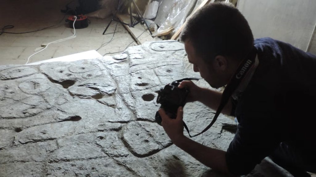
Archaeologists have since embarked on a quest to decipher the remaining symbols and landmarks on the stone, hoping to uncover more ancient sites in north-western France.
Forging New Paths in Archaeology
The use of the Saint-Belec slab as a treasure map is a novel approach in the field of archaeology. Traditionally, ancient sites are discovered through radar equipment, aerial photography, or accidental finds during construction projects.
However, the slab offers a unique opportunity to explore the Bronze Age landscape in a different way. Researchers are excited about the prospect of using the stone to guide their search for archaeological sites, a method that has not been commonly employed in the past.
Charting New Archaeological Frontiers: Saint-Belec Slab Pioneers Treasure Map Approach to Uncover Ancient Sites
Yvan Pailler, a professor at the University of Western Brittany, expressed his enthusiasm for this new approach. He described the slab as a “treasure map” and highlighted the significance of using it to find archaeological sites. The researchers have already made some intriguing discoveries.
By comparing the markings on the slab with modern maps, they have identified the rivers and mountains of Roudouallec, a region in Brittany located about 500 kilometers west of Paris. This initial success has fueled their determination to uncover more hidden treasures.
A 15-Year Quest to Unlock the Secrets: Researchers Dedicate Themselves to the Ongoing Exploration of the Saint-Belec Slab
The journey to understand the Saint-Belec slab is just the beginning. The researchers estimate that it could take up to 15 years to fully explore the map and uncover all its secrets. They are committed to meticulously surveying the entire territory and cross-referencing the markings on the slab with the landscape.
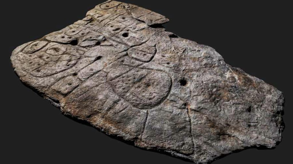
The tiny hollows on the stone, believed to indicate burial mounds, dwellings, or geological deposits, hold the promise of even more significant discoveries.
The Past’s Hidden Treasures: The Saint-Belec Slab’s Enigmatic Hollows Lead the Way
This 4,000-year-old stone, once overlooked and forgotten, has now become a treasure map guiding researchers to the secrets of the past.
As they continue their quest, the researchers hope to shed light on the Bronze Age landscape and gain a deeper understanding of the people who lived there.