More than a century ago, in 1900, a stone slab with strange carvings was discovered in an ancient burial ground in France. The peculiar slab was stored away in a basement for decades until it was rediscovered in 2014.
A modern analysis of the stone slab, which has become known as the Saint-Belec slab, has led to an extraordinary theory … that the carvings on the stone are actually a map of the region. In fact, it is believed that the Saint-Belec slab may be an ancient treasure map.
The Discovery of the Saint-Belec Slab
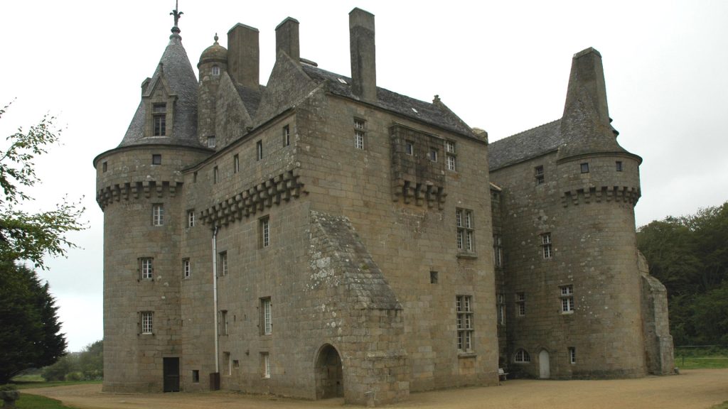
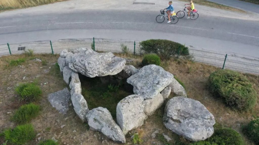
French scholar and researcher Paul du Chatellier discovered the Saint-Belec slab in 1900. It was found as part of the wall of a burial structure in Finistere, located in western Brittany. He didn’t know what the carvings meant, but he knew they were unusual.
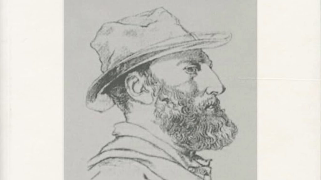
Du Chatellier took the stone slab to his home, Chateau de Kernuz, where it was placed in the cellar along with other artifacts in his sizable collection. The collection was given to the National Archaeology Museum, but no one gave the Saint-Belec slab a second look. At least, not until 2014.
A Sizable Slab
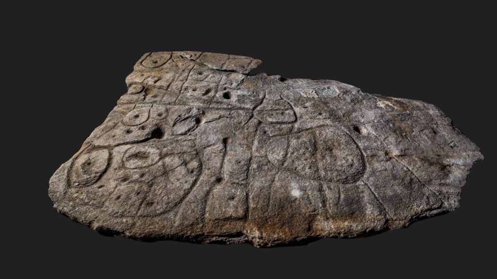
The Saint-Belec slab is made of metamorphic gray-blue schist which scientists believe came from an outcropping in nearby Douarnenez. The part that du Chatellier was able to recover from the wall of the burial crypt measured more than seven feet long, five feet wide, and about six inches thick.
The slab, however, is much older than the burial crypt. The builders of the burial crypt probably used materials at hand, reusing and repurposing existing stones. It appears that the slab was broken prior to being used in the crypt. The upper portion of the slab remains missing, and experts theorize that it could have been as large as 12 feet in length.
The Early History of the Saint-Belec Slab
The burial crypt where the Saint-Belec slab was found in 1900 was built between 1900 and 1600 BC. Experts have determined that the slab was carved sometime around 1875 BC, during the Bronze Age. That makes it the oldest known map in Europe.
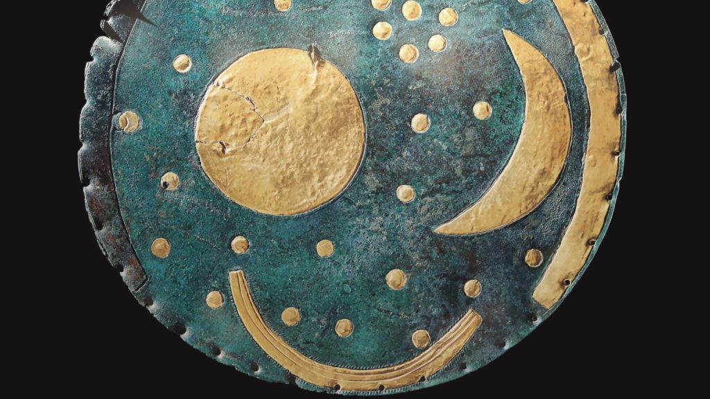
In fact, researchers believe it is “probably the oldest map of a territory that has been identified.” Another map, the Nebra sky disc, which was discovered in Germany, was made at roughly the same time, however this is a star map, not a land map.
Finding a Lost Relic
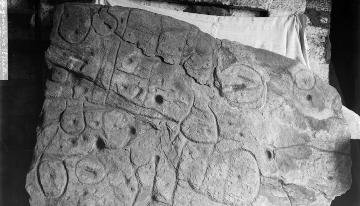
In 2014, researchers combing through the cellar at Chateau de Kernuz to classified items in the National Archaeological Museum’s collection rediscovered the Saint-Belec slab. Du Chatellier had written about the “remarkable monument” and referenced the lines, circles, and images of cups on the stone slab.
When du Chatellier passed away in 1911, the artifacts in his collection passed to France’s National Archaeological Museum. Upon its rediscovery, a team of scientists and researchers was assembled to thoroughly study the Saint-Belec slab.
A Joint Study of the Saint-Belec Slab
Experts from the French National Centre for Scientific Research, the French National Institute for Preventive Archaeological Research, the University of Western Brittany, and Bournemouth University came together for an in-depth study of the Saint-Belec slab.
The joint study took place between 2017 and 2021. Their findings were published in a journal article in the Bulletin de la Societe Prehistorique Francaise. The conclusion that the team of experts presented caused a stir among historians, scholars, and archaeologists.
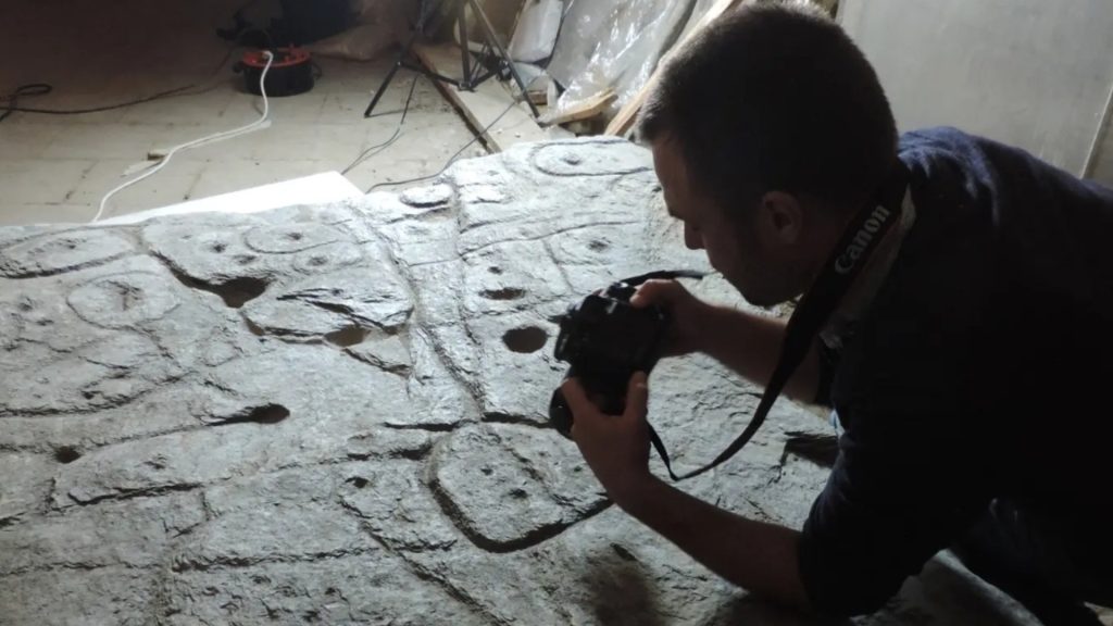
Digitally Analyzing the Engravings on the Slab
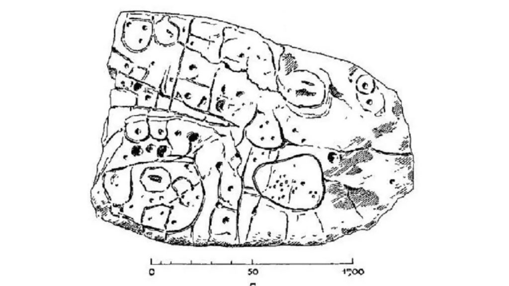
The researchers used 3D surveys and photogrammetry to study the engravings on the Saint-Belec slab and to digitally record them. The lines and symbols on the stone reminded the experts of symbols on a map so the team decided to test this idea.
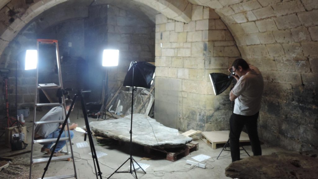
When they superimposed the slab’s symbols with a geographical map of the area, they realized that many of the symbols aligned perfectly with the geography of Odet Valley in Finistere. In fact, 80% of the features matched the slab, including a line that matches the path of a river. In all, the area shown on the slab represents a region that is 19 miles by 13 miles in size.
Who Made the Map and Why?
Historians theorize that the map on the Saint-Belec slab was carved in the Bronze Age by a prince or king that ruled in the area. The map, they contend, shows where the ruler was buried and where his valuable possessions were hidden.
Some of the experts go as far as to say that the king or prince was a tyrannical leader. They point to the fact that the slab was broken in two and used as a material when building the burial crypt. This may have been an attempt to erase the king from history.
The Symbols on the Map
In the center of the Saint-Belec slab there is a circular engraving. The research team believes that this may signify the prince’s home or burial site.
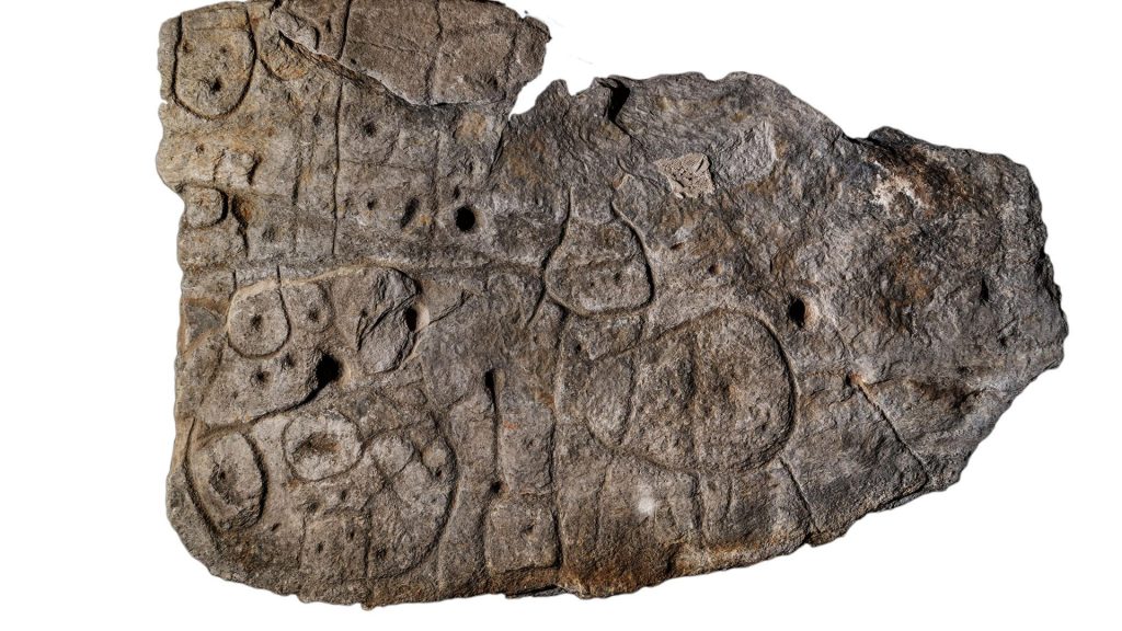
They further suggest that the central circular carving lines up with two rivers, the Isole and the Ster Laer. The team also asserts that the map was not created as a navigation aid. Instead, they believe the map recorded the kingdom’s boundaries or showed land ownership.
An Outdated Map
It could be that the Saint-Belec slab was used by the Bronze Age ruler to control the land usage in his kingdom. The slab may have been discarded when the king fell out of power.
“The engraved slab no longer made sense and was doomed by being broken up and used as building material,” explained Nicolas.
Following the Map
Now that the joint team of researchers have determined that the carvings on the Saint-Belec slab represent a map, archaeologists are trying to follow the map to see if it leads to any undiscovered archaeological sites.
According to Professor Yvan Pailler of the University of Western Brittany, “Using the map to try to find archaeological sites is a great approach. We never work like that.” He even referred to the Saint-Belec slab as “a treasure map.”
The Map Is Incomplete
Clement Nicolas of Bournemouth University, a lead researcher on the joint team studying the Saint-Belec slab, noted, “What we’re missing now is the map key, the decoder.”
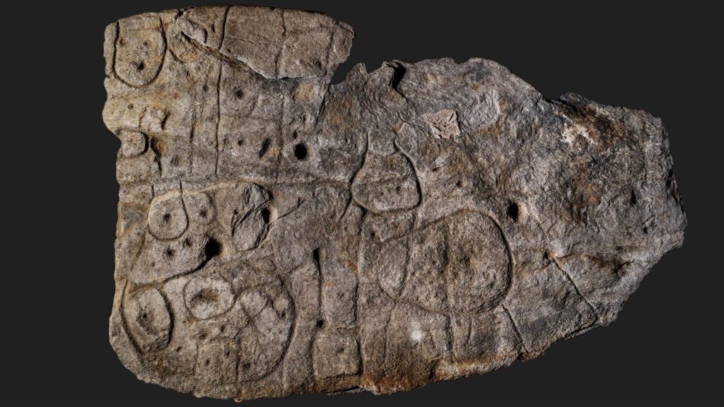
“We now have the technology to know exactly what an area looks like from above,” Pallier added. “The significance of the lines and bumps in the rock became immediately apparent.” What is not known is what the cup-like engravings are. They could indicate burial mounds or mineral deposits.
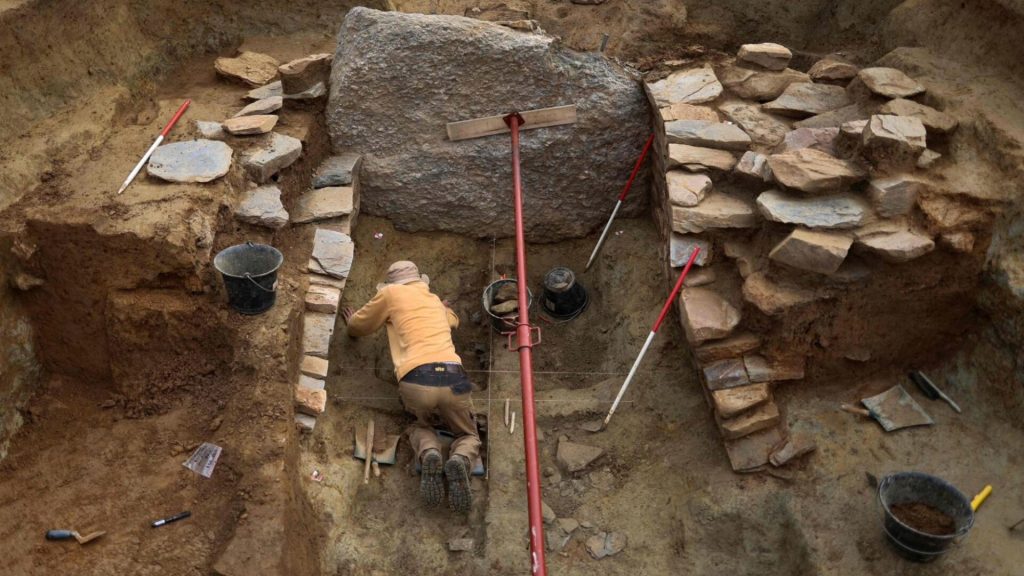
The Search Is on For the Missing Pieces
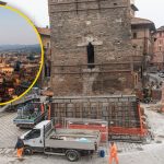
Pallier explained that, in the past few weeks, a research team has been working at the site where Paul du Chatellier originally found the Saint-Belec slab in 1900. They are hoping to find evidence to help them more definitively date the slab.
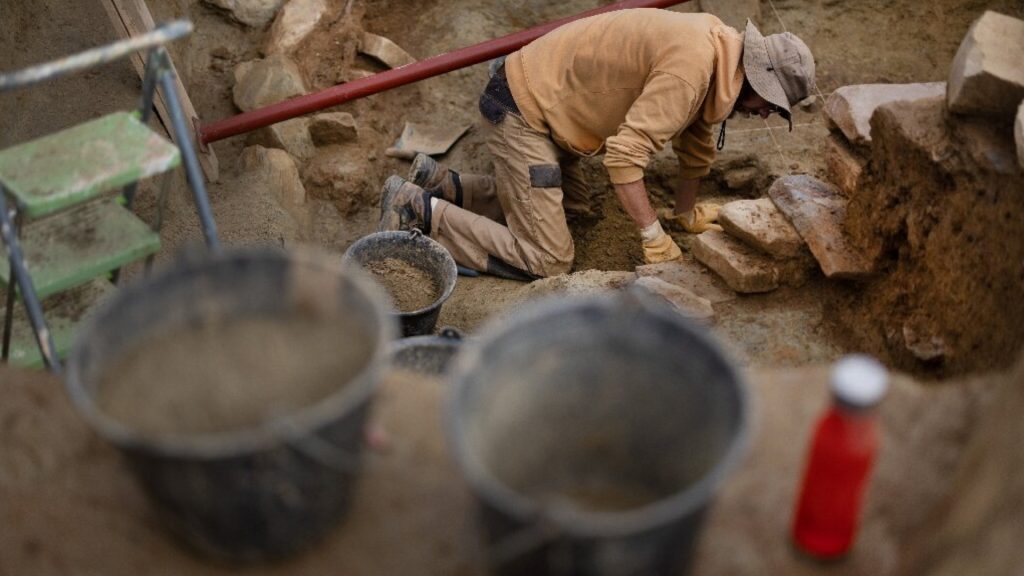
The main focus of their excavation efforts, however, is to search for lost portions of the Saint-Belec slab. Incredibly, the team has uncovered a few of these lost fragments. They hope they will find additional information to help them decipher the slab.